Subject: Northern South America
Period: 1730 (circa)
Publication:
Color: Hand Color
Size:
22.6 x 19.8 inches
57.4 x 50.3 cm
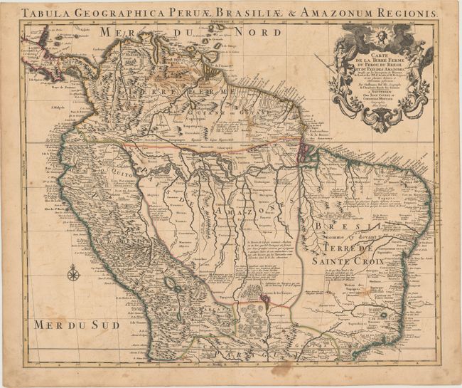
This handsome and important map of the northern part of South America is based upon Delisle's earlier map and is filled with information and notations speculating about the Indian tribes and the tributaries of the Amazon. The capitaineries are shown along the coast of Brazil. A notation in Guyana notes the mythical Lac de Parime on which the golden city of Manoa del Dorado was supposed to be located. The central part of the map (Pays des Amazones) is filled with Indian names. The Inca Way (Grand chemin des Ingas) is shown from Chuquisaca in Peru to Pasto in Colombia. The title cartouche features mythical Amazon warriors, a pot of gold and King Louis XIV, as the Sun King.
References:
Condition: B
Original color with several brown stains in the image and a short centerfold separation at top that is confined to the blank margin and has been closed on verso with archival tape.