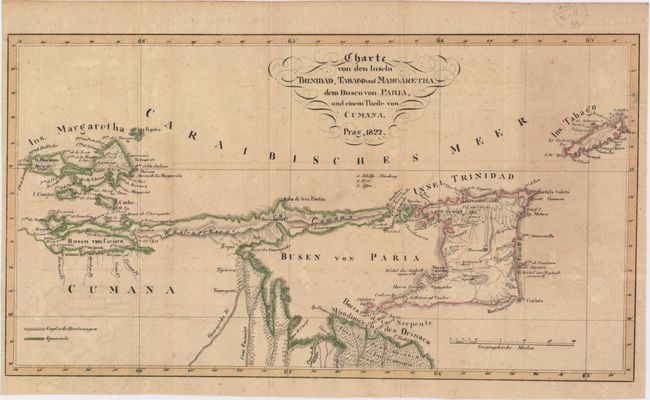
Subject: Trinidad & Tobago
Period: 1822 (dated)
Publication:
Color: Hand Color
Size:
15.9 x 8.8 inches
40.4 x 22.4 cm
This interesting chart covers from the Margarita Island off the coast of Venezuela to Tobago. It includes part of the of the Venezuelan coastline and provides a surprising amount of detailed information. The map is colored to show the colonial possessions; Trinidad and Tobago are British, with the remainder being Spanish. Since it was first sighted by Columbus in 1498, Tobago experienced a tumultuous history, changing hands over 30 times between the Dutch, English, Spanish, Swedish and French. The British were ceded Tobago from France in the Treaty of Paris in 1814; however after the sugar industry collapsed in the mid-nineteenth century, the British relinquished their control over Tobago and it became a ward of Trinidad in 1889.
References:
Condition: B+
Issued folding with light toning and offsetting.