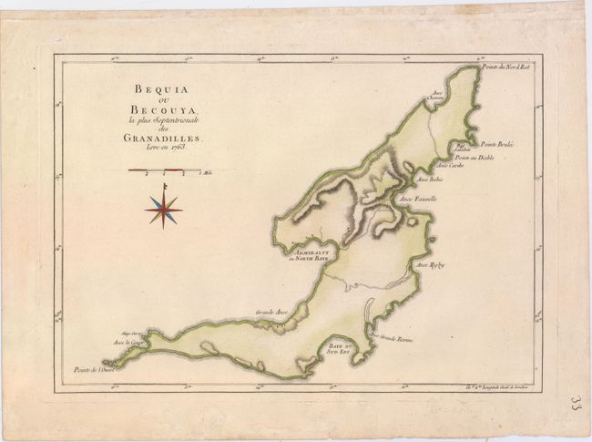
Subject: Bequia, the Grenadines
Period: 1779 (circa)
Publication:
Color: Hand Color
Size:
17.8 x 12.4 inches
45.2 x 31.5 cm
This is the uncommon French version of Thomas Jefferys' map showing the survey of 1763, which was undertaken when the island was granted to the British in the Treaty of Paris. Bequia is the northernmost and largest island in the Grenadines. The map shows a few buildings, fortifications, roads and harbors, which were built by French who settled the island in the early 1700s. The isolated island was also a favorite base for several infamous pirates including Captain Edward Teach, Sir Francis Drake, and Henry Morgan. In the 18th century Admiralty Bay was the safest natural harbor in the Eastern Caribbean in which to seek refuge from hurricanes. The island is now a favorite yachting destination.
References:
Condition: A
A nice impression on watermarked paper with some minor soil in the wide blank margins.