Catalog Archive
Auction 147, Lot 218

"Map G. No. 52. Chicago Harbor & Bar, Illinois. From Survey Made in April 1857 under the Direction of Brevet Lieut. Col. J.D. Graham…", Graham, James D.

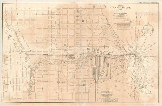
Subject: Chicago, Illinois

Period: 1858 (published)

Publication: Sen. Ex. No. 1, HO. Ex No. 2, 2nd Session, 35th Cong.

Color: Black & White

Size:
48.5 x 55 inches
123.2 x 139.7 cm
Download High Resolution Image
(or just click on image to launch the Zoom viewer)

This large format map of Chicago Harbor depicts the North Pier, the South Pier, as well as the proposed extension to the South Pier. Both the harbor and the Chicago River are filled with information including soundings, buoys, navigational hazards and notations. Along the lake shore, the numerous buildings and rail lines of the Illinois Central Railroad are depicted. In the city, streets are named, but there is little additional information beyond a few buildings including City Hall, the Marine Hospital, and several churches. Drawn on a scale of 200 feet per inch, this map accompanied Graham's report to the Chief Engineer.

References:

Condition: B

Backed with tissue to reinforce and repair numerous fold separations, chips and cracks. Light uneven toning and minor foxing and offsetting.

Estimate: $275 - $350

Sold for: $220

Closed on 11/20/2013

Archived