Subject: Atlantic Ocean
Period: 1740 (published)
Publication: London Magazine
Color: Hand Color
Size:
16.8 x 12 inches
42.7 x 30.5 cm
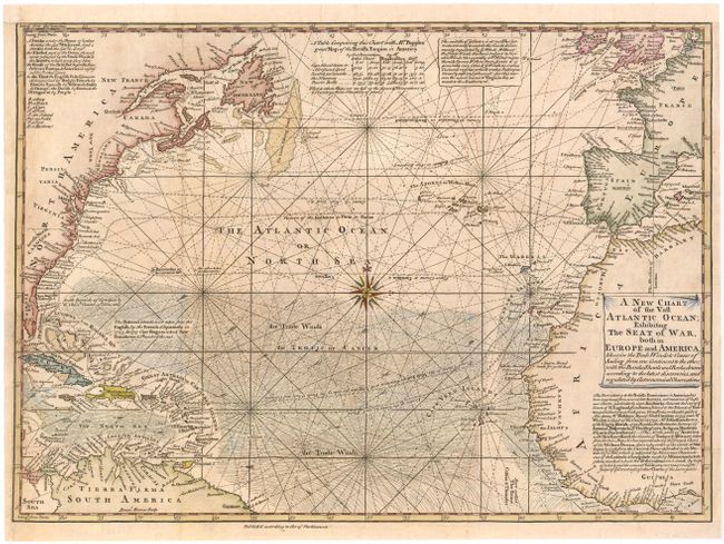
Fine copper engraved chart details the trade winds and sailing courses across the Atlantic. The area covered includes most of eastern North America through northern South America, and western Europe through northwestern Africa. Ornamented with rhumb lines, a beautiful compass rose and a decorative scroll-style title cartouche. The map is filled with numerous notes and comments. A note below the title details Bowen's sources, including Capt. Cyprian Southack’s 1731 map of New England, Edward Moseley’s 1733 map of North Carolina, and James Wimble’s 1739 map of the Carolinas. A table at top center compares position data between this map and "Mr. Popple's great Map of the British Empire in North America." Jolly calls this "a nicely executed map." This is the first edition and not to be confused with the 1755 state.
References: Jolly #LOND-7.
Condition: B+
Issued folding, now pressed, with very light toning and professional repairs to a binding trim at bottom left and associated binding tear that enters 1/2" into map. Remargined at top with old paper. There is a tiny tear in an unengraved area of northern Africa that has also been professionally repaired.