Subject: Southeast Australia
Period: 1852 (dated)
Publication: London Atlas
Color: Hand Color
Size:
24.5 x 20.8 inches
62.2 x 52.8 cm
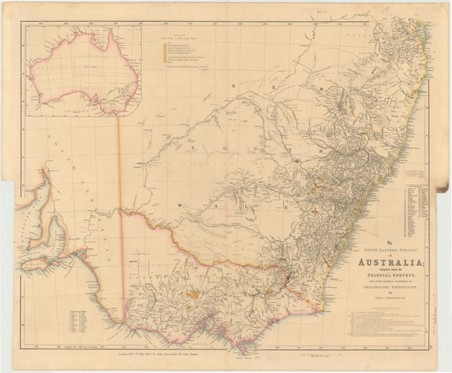
This detailed map covers from the Brisbane region south to Spencer Gulf in South Australia. It replaced Arrowsmith’s Discoveries in Australia map in the London Atlas and provides a more detailed view of the region on a larger scale. It was published between 1838 and 1858 and went through twelve states that defined the major river systems and illustrated the discoveries in the interior and the development of settlement. This is the tenth state, notable for showing the gold discoveries with a color key at top left. Also the new colony of Victoria is shown for the first time. An inset shows the full continent and tables list the counties in Port Phillip and New South Wales. The major exploration routes are noted in a table below the title and the Australian Agricultural Land Company’s holdings are shown.
John Arrowsmith’s maps of the British colonies in Australia were the largest scale maps produced during the early part of the 19th century. Drawn largely from official sources and surveys, his work is of utmost importance in the cartographic history of Australia.
References: Tooley (Aust) #98; Prescott http://www.asmp.esrc.unimelb.edu.au/biogs/E000088b.htm
Condition: A
Original color with a professionally repaired short tear at binding trim.