Catalog Archive
Auction 143, Lot 777

"Carte des Nouvelles Decouvertes dressee par Phil. Bauche… [on sheet with] Extrait d'Une Carte Japonise de l'Univers…", Robert de Vaugondy, Didier

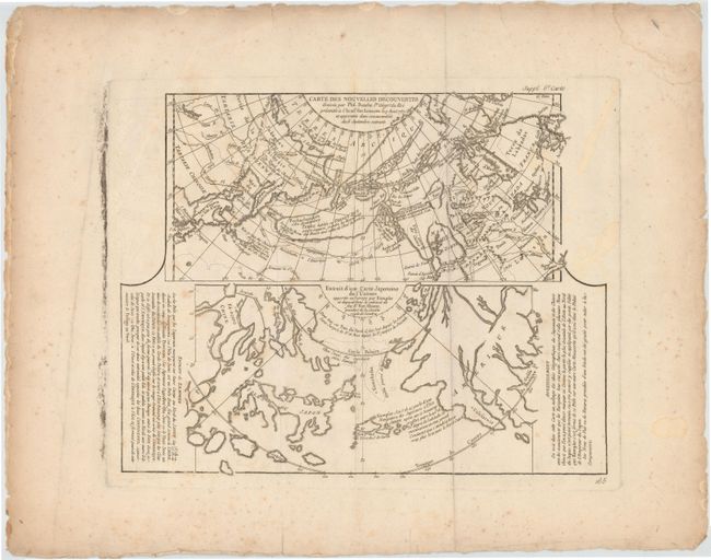
Subject: North Pacific Ocean

Period: 1772 (circa)

Publication: Diderot's Encyclopedie (Supplement)

Color: Black & White

Size:
14.5 x 11.5 inches
36.8 x 29.2 cm
Download High Resolution Image
(or just click on image to launch the Zoom viewer)

Two very contrasting maps within a single border. Each map covers the north Pacific, including the continents bordering it. The top map depicts the theories of Philip Buache concerning the Northwest Passage, with numerous possible routes through North America, including Lace de Valasco, Lac de Fonte and Mer de l'Ouest. Alaska is shown as an elongated island. In Asia, Kamchatka is fairly well formed but Japan is still quite misshapen. The bottom chart depicts the region per Kaempfer, with Japan nicely detailed, but the coasts of both Asia and North America very deformed.

References: Falk (AK) #1752-2; Wagner (NW), pp. 158-162; Pedley #452; McGuirk #146; Kershaw #1230.

Condition: B

Issued folding on watermarked paper with wide margins, scattered foxing and staining, and printer's ink residue along the left platemark.

Estimate: $250 - $325

Unsold

Closed on 2/13/2013

Archived