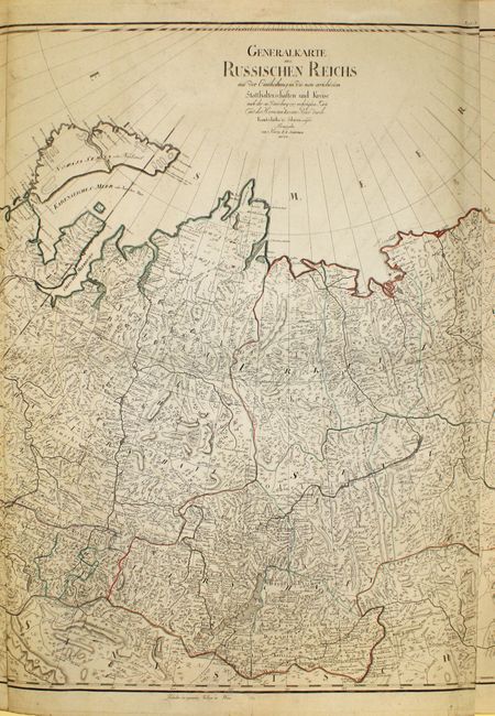
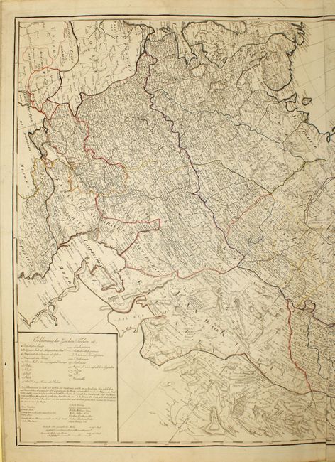
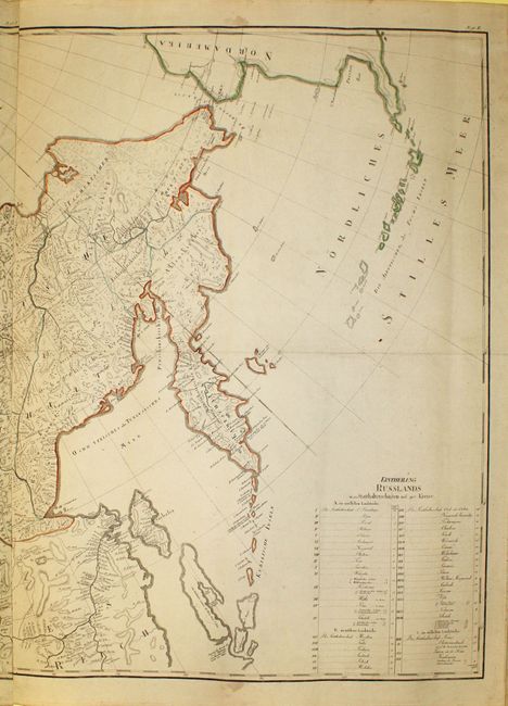
Subject: Russia
Period: 1792 (dated)
Publication: Allgemeiner Grosser Atlass
Color: Hand Color
Size:
67 x 31.2 inches
170.2 x 79.2 cm
This massive map of the Russian Empire extends from the Baltic and Black Seas in the west to Alaska in the east. The map includes improvements based on a map of the region published in Petersburg in 1787, as well as the explorations of Jean-Baptiste Barthelemy de Lesseps through Siberia and Kamchatka from 1787-88. Lesseps was a French diplomat and writer who traveled across Russia on behalf of La Perouse, who was in route to Australia. The map is fully engraved with towns, political boundaries, rivers, and topographical details. A large legend at bottom left identifies towns of various sizes, mountains, deserts, sand dunes, etc. and explains the use of color on the map. A counter-balancing table at bottom right lists 42 principal cities of various regions in Russia. Printed on three sheets, joined.
References: Phillips (Atlases) 694-17.
Condition: A
Original outline color with very minor soiling and a few short tears confined to blank margins. Remarkable condition considering the size of this map.