Subject: Western Chile
Period: 1750 (circa)
Publication:
Color: Hand Color
Size:
12.1 x 10 inches
30.7 x 25.4 cm
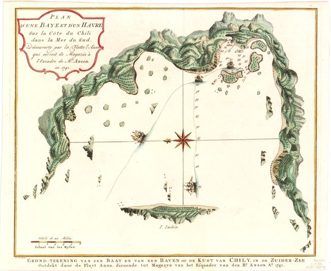
This chart of the western coast of Chile is from an account of Anson's circumnavigation, one of the last great buccaneering voyages. It illustrates the track of Anson's ships through a bay in Chili and the an island named I. Inchin, with a number of depth soundings shown. The coastline is well charted but there are no details inland. The chart was beautifully engraved by Jacob van der Schley with a large compass rose orienting north to the left.
In 1740 Anson set sail in command of a squadron sent to attack Spanish possessions and interests in South America during the War of Jenkin's Ear. The ill-equipped expedition failed to carry out its original ambitious mission and the squadron nearly perished. In June 1741 Anson collected the remaining survivors on his flagship, the Centurion, and set sail in search of one of the richly laden galleons that conducted the trade between Mexico and the Philippines. The indomitable perseverance he had shown during one of the most arduous voyages in the history of sea adventure gained him the reward of an immensely rich prize, the Nuestra Señora de Covadonga, which he encountered off Cap de Espiritu Santo on June 20, 1743.
References:
Condition: A
Just a hint of offsetting.