Subject: Lesser Antilles
Period: 1702 (circa)
Publication:
Color: Hand Color
Size:
22.9 x 18.1 inches
58.2 x 46 cm
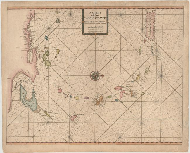
This is an extremely rare English chart of the Lesser Antilles. It extends from Puerto Rico to Trinidad and west to the Los Roques islands, and covers a portion of the coastline of Venezuela. Detail is confined to coastal place names with banks and navigational hazards shown in the seas. The map is adorned with a simple title cartouche and a large compass rose orienting north to the right.
This map is a collaborative effort by Jeremiah Seller and Charles Price. Jeremiah, John Seller's son, apprenticed under his father and was a mapmaker, instrument-maker and publisher. He formed a partnership with Price, another young mapmaker, and became "Hydrographers to ye Queen" and "Compass makers to the Navy Royall." In about 1705, complaints over the quality of their instruments caused Seller and Price to lose their contract with the Admiralty and the firm was forced into bankruptcy. Thus their maps are rare in today's market.
References:
Condition: B
Printed on heavy, watermarked paper with light soiling, a few small abrasions, and a couple of tiny worm tracks that have been archivally repaired. There are a few tears in the ocean at right that have also been archivally repaired.