Subject: Colonial Mid-Atlantic, Delaware Bay
Period: 1777 (dated)
Publication:
Color: Black & White
Size:
25.8 x 19 inches
65.5 x 48.3 cm
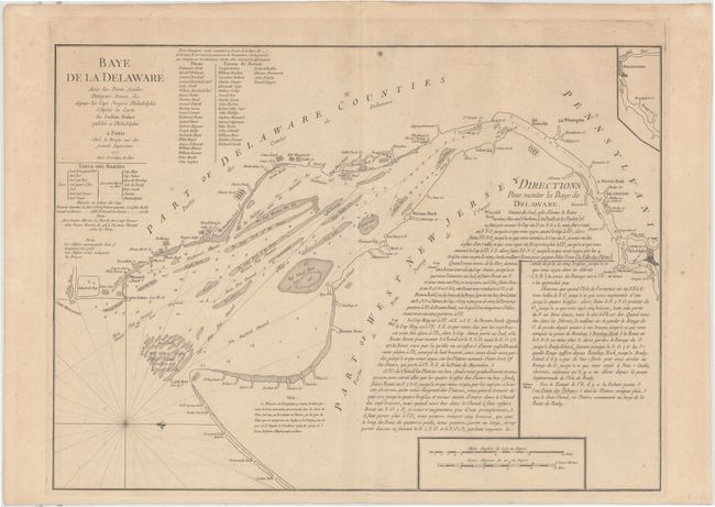
French derivative of the important Revolutionary War chart by Joshua Fisher. This plan of the bay and river was originally published in 1775 to assist pilots in bringing ships into Philadelphia, and was considered one of the most accurate and detailed of its time. The map is filled with sailing instructions, soundings and notes on hazards. A small inset at top right continues the navigation just past Philadelphia. A list of subscribers is adjacent to the title, complete with 22 pilots and 22 masters of vessels who believe the chart would help 'safe navigation' in the bay. A tide table is located just below the title. This uncommon and accurate map, published by le Rouge, was intended for use by the French military, merchants, and politicians.
References: Phillips (Atlases) #1210-9; Sellers and Van Ee #1357.
Condition: B+
A fine impression on thick hand laid paper with a watermark. There is a 1.5" tear along the platemark at right, and a few small spots.