Subject: Western Hemisphere
Period: 1819 (dated)
Publication:
Color: Hand Color
Size:
17.8 x 23.5 inches
45.2 x 59.7 cm
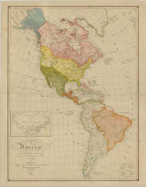
Large attractive map of the Americas depicting the political boundaries and European possessions in the western hemisphere via a colored key at bottom. There is good detail throughout with the exception of the unexplored regions in northwestern North America. The United States is depicted with its new acquisition of Louisiana Territory and extends north into present-day British Columbia, reflecting US claims to the area. Mexico encompasses Texas and extends north to the 42nd parallel. West of California are an erroneous group of islands with Spanish names. These islands were introduced on maps in the mid-18th century and were not corrected until the early 19th century. The South American continent is very well mapped and filled with detail. The map includes a large inset of Catharina's Archipelagus (the Aleutians).
References:
Condition: B+
Original color on watermarked paper with a few light spots and some small abrasions.