Subject: Texas
Period: 1861-87 (circa)
Publication:
Color:
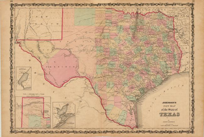
A. Johnson's New Map of the State of Texas, by Johnson & Browning, from Illustrated Family Atlas of the World, published 1861, hand color (24 x 17"). The first edition of this handsome map, with county development mostly in eastern Texas and only the three large counties of El Paso, Presidio, and Bexar in the west. The panhandle, noted as the Staked Plain (Elevated Table Land, without Wood or Water), includes a large section that is unorganized. There are numerous wagon roads, a few completed railroads, and the US Mail Route traced on the chart. Insets include a Plan of Sabine Lake, Plan of the Northern part of Texas, and Plan of Galveston Bay. Surrounded by Johnson's early strapwork border. Blank on verso. Condition: Toned with some light offsetting and a centerfold separation at bottom that enters 0.5" into border. (B)
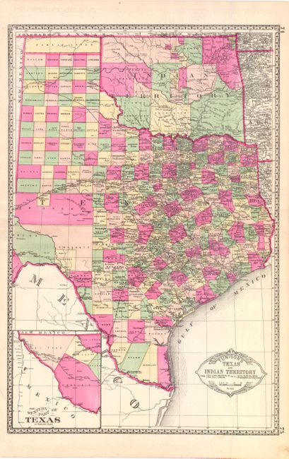
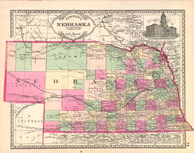
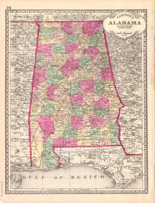
B. Tunison's Texas and Indian Territory, by H.C. Tunison, from Peerless Universal Atlas of the World, published 1887, hand color (13 x 19.5"). In Tunison's style, this is a finely lithographed map with original bright coloring. By this period most mapmakers had adopted printed color rather than the more labor intensive hand coloring employed here. Tom Green County is shown in a large, early configuration, not yet divided into Sterling, Irion, and Coke. Good detail of railroads with all stops located and named. Decorated with a Victorian style border and title cartouche, which gives the population of Texas as 1,591,749. At lower left, the inset "The Western Part of Texas on Reduced Scale" shows the counties of El Paso, Presidio, Reeves, and part of Tom Greene and Pecos. The panhandle of Oklahoma is Public Lands. Indian Territory is clearly divided into about 20 different Indian lands. Greer County, originally established in 1860, is here unnamed and still part of Texas. It was abolished and awarded to Indian Territory by a Supreme Court decision in 1896. Tunison's maps were printed on both sides; on the verso are single-page maps of Nebraska and Alabama. Condition: There are a few tiny edge tears that do not enter image, else fine. (A)
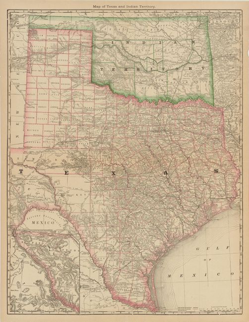
C. Map of Texas and Indian Territory, by Hardesty, circa 1884, printed color (19" x 25"). Similar in geography to the map above. Tom Green County is shown in a large, early configuration, not yet divided into Sterling, Irion, Coke, and Midland. This map, however, shows Greer County identified and appearing in Indian Territory and the panhandle is also included in Indian Territory. At lower left is an inset showing El Paso, Presidio and Pecos counties. Printed on thin banknote paper. Condition: Issued folding with a short split and tear at the fold intersection, else good. (B)
References:
Condition:
See descriptions above.