Catalog Archive
Auction 141, Lot 473

"A Correct Map of the Island of Minorca, with an Accurate Plan of Fort St. Philip & its Environs, and the French Approaches and Batteries in 1756", Bew, John

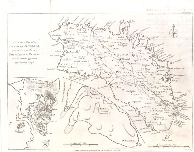
Subject: Minorca, Spain

Period: 1781 (dated)

Publication: Political Magazine

Color: Black & White

Size:
14.8 x 10.8 inches
37.6 x 27.4 cm
Download High Resolution Image
(or just click on image to launch the Zoom viewer)

This detailed map of Minorca, one of the Balearic Islands off the coast of Spain, was drawn shortly after the Spanish regained control of the island from the British during the Seven Years War. The map shows detail of roads, coastline, castles and topography. There is also an inset of Fort St. Philips, which served to protect the harbor that led to the capital city of Mahon. Engraved by John Lodge.

References: Jolly #POL-33.

Condition: B+

Issued folding, now flattened, on watermarked paper, with a narrow margin at right. There is light soiling, offsetting from opposing text page, and a professionally repaired tear that enters 3.5" into map at right, primarily in the blank areas of the map.

Estimate: $150 - $200

Sold for: $100

Closed on 9/5/2012

Archived