Catalog Archive
Auction 141, Lot 310

"Isole Antili, la Cuba, e la Spagnuola…", Coronelli, Vincenzo Maria
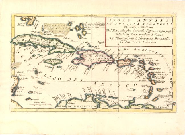
Subject: Caribbean

Period: 1695 (circa)

Publication: Isolario Descrittione Geografico…

Color: Hand Color

Size:
17 x 10 inches
43.2 x 25.4 cm
Download High Resolution Image
(or just click on image to launch the Zoom viewer)

Coronelli's scarce map of the Caribbean extends from the southern tip of Florida and the Canale di Bahama to the easternmost Antilles and Trinidad. The detailed map is centered on Hispaniola and includes several smaller islands such as the Caymans, Virgin Islands and several islands off the Yucatan Peninsula. A note in the Lucayan archipelago of the Bahamas, identifies Guanahani, the native name for the island where Columbus supposedly landed in 1492 and subsequently called San Salvador.

References: Shirley (BL Atlases) T.CORO 13-a #214.

Condition: A

Wide margins with three minute worm holes just below title cartouche, only visible when held to light.

Estimate: $700 - $800

Sold for: $550

Closed on 9/5/2012

Archived