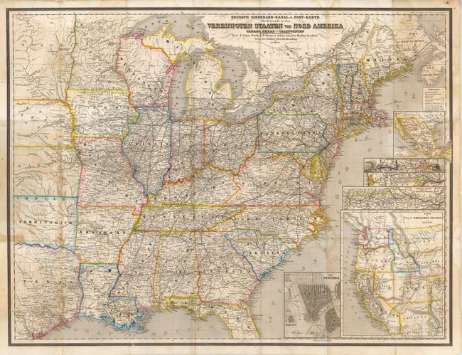
Subject: Eastern United States
Period: 1863 (circa)
Publication:
Color: Hand Color
Size:
29 x 21.5 inches
73.7 x 54.6 cm
This is a very detailed German pocket map of the United States, issued during the Civil War. West Virginia is still shown as a part of Virginia. The states and territories are shown with detail of railroads, rivers, topography and emigrant roads. There are six inset maps that display the western United States, Mexico, a city plan of New York, and small maps showing railroad routes between major eastern cities. The inset map of the West shows the newly created territories of Idaho, Nevada and Arizona, with Nevada in its smallest configuration and Dakota Territory encompassing the region that would become Wyoming.
Traugott Bromme was one of the most prolific German travel writers in the mid nineteenth century. He issued a number of travel guides to America, as well as a number of important German atlases. His work was very influential in the influx of Germans who comprised the largest group of immigrants to the United States between 1840 and 1880.
References:
Condition: B
There is scattered damp staining in the image and several tiny splits at fold intersections. There are some pencil markings on verso but it does not impact the image. Issued folded with paper pastedowns and the front cover appears to be missing.