Subject: Southeast Asia
Period: 1525 (published)
Publication: Claudii Ptolemaei Geographicae…
Color: Hand Color
Size:
16.5 x 11 inches
41.9 x 27.9 cm
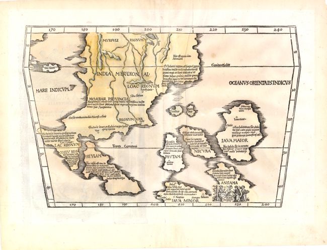
This scarce map is a landmark in the cartography of Southeast Asia - the first printed map to focus on the region of Malaya, Indochina and the East Indies. It was based on Waldseemuller's large 1507 cordiform world map, which was in turn taken from the Martellus model with nomenclature derived principally from Marco Polo. The mythical Lake Chiang Mai, labeled Lamia Lacq, is located at the top border. The islands are placed in a barely recognizable fashion including Iava Maior in roughly the position of Borneo. The map's nomenclature is derived principally from Marco Polo. A small vignette illustrating cannibalism is set in the island of Angama (Andaman Islands), which is totally misplaced to the east of Java.
References: Nordenskiold (Volume 2) #208-42; Suarez (SEA) Fig 62 pp.114-118.
Condition: B
There are scattered wormholes in the image that have been professionally repaired on verso and an extraneous crease to the right of the centerfold. The old color is a bit faded.