Subject: Iceland
Period: 1630 (circa)
Publication:
Color: Hand Color
Size:
19.5 x 15 inches
49.5 x 38.1 cm
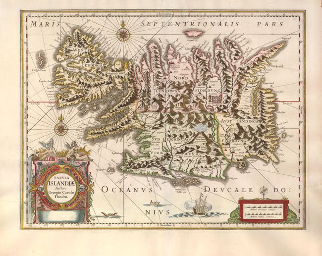
This handsome copper engraved map of Iceland was based on information from a Dutch navigator named Joris Carolus in about 1620. The map shows the influence of both versions of Bishop Gudbrandur's previous maps, a coastline resembling the Ortelius version, and Mercator's selection and spelling of many place names. The island's topography is dominated by huge mountains and volcanoes and its shoreline is a rugged labyrinth of fiords. It is richly embellished with title and distance scale cartouches, compass roses, rhumb lines, a sailing ship and two sea monsters. The cartouche features two winged sprites, an important symbol in Icelandic and Norse mythology. Along with elves and dwarves, sprites were magical beings who aided the gods. The map was first issued by Jodocus Hondius and later re-issued by Willem Blaeu. This example does not include a publisher's imprint. It became the prototype for the mapping of Iceland and its influence did not wane until the mid-18th century.
References:
Condition: B+
A bright example with wide original margins. There is a clean, and now virtually invisible, repaired tear above the distance scale. Manuscript page number in upper-right corner.