Subject: Eastern Asia
Period: 1851 (circa)
Publication: llustrated Atlas and Modern History of the World
Color: Hand Color
Size:
13 x 9.5 inches
33 x 24.1 cm
The maps from The Illustrated Atlas were first published in serial form to a target audience that led insular lives due to the expense and hardship of travel. All that changed as the progress of the nineteenth century brought swift and dramatic changes in public awareness of far away places. Tallis' maps no doubt played an important role in this dramatic awakening. These maps not only provided up-to-date geographical knowledge, but also used vignette views within the map's design to show the native people and their occupations, cities and points of interest. The maps hark back to a cartographic tradition from the Dutch mapmakers of the seventeenth century with finely engraved decorative borders. The maps were drawn and engraved by John Rapkin with views drawn and engraved by a number of prominent artists. The maps were issued as a complete volume from 1851 until about 1865. Some of the maps were also published in other history books published by Tallis including British Colonies and, without the vignettes, in geographical dictionaries and encyclopedias until about 1880.
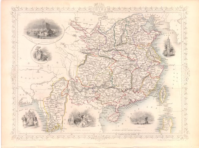
A. China and Birmah is a most decorative map of China and Burma. The detailed map of the region also names many locations on Taiwan (Formosa). The very attractive steel engraved vignettes include British Factories - Canton, Hong Kong, a pagoda, Chinese Soldiers, and two showing native costumes. It is further embellished with a decorative border and title included in a cartouche at top center of the border.
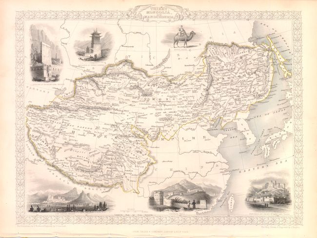
B. Thibet, Mongolia, and Mandchouria is a fine steel engraved map with six vignettes and decorative borders. It covers the region from Tibet through northwestern China to Manchuria. Includes vignettes of the Fortress and Palace of Dalai Lama at Lassa, the Chinese Wall, Leh in Little Thibet and others.
References:
Condition: A
The original outline color is typical for the period in that is was applied when children were employed as colorists. The bottom blank margins are slightly crumpled where the maps were bound and there is slight toning n the blank margin, else fine.