Subject: New York
Period: 1883 (dated)
Publication:
Color: Black & White
Size:
23 x 29 inches
58.4 x 73.7 cm
The Office of Coast Survey is the oldest U.S. scientific organization, dating from 1807 when Congress directed that a "survey of the coast" be carried out. By 1836, it was called the U.S. Coast Survey and in 1878, the name was changed to the U.S. Coast and Geodetic Survey. Today the Office of Coast Survey is a division of the National Oceanic and Atmospheric Administration NOAA.
The survey teams, composed of civilians as well as Army and Naval officers, charted the nation's waterways and produced a wide array of reports, survey charts, hydrographic studies of tides and currents, astronomical studies and observations, and coastal pilots. These charts are an important record of the changing nature of the nation's coastlines. In additional to coastal charts, the U.S. Coast and Geodetic Survey produced land sketches, Civil War battle maps, and the early aeronautical charts.
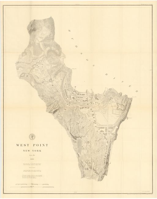
This highly detailed and accurate plan of the Military Academy extends to include the Delafield Reservoir, observatory and the Engineer's Gardens. There is good detail of the fortified Fort Clinton and its batteries. The map is precisely and fully engraved. This early (1883) edition does not have the red overprinting to locate the proposed new Academic Building and Gymnasium. Engraved from the original by H.C. Evans with title and lettering by E.A. Maedel.
References:
Condition: A+
Excellent condition.