Subject: Minorca
Period: 1782 (dated)
Publication:
Color: Hand Color
Size:
21.7 x 16.3 inches
55.1 x 41.4 cm
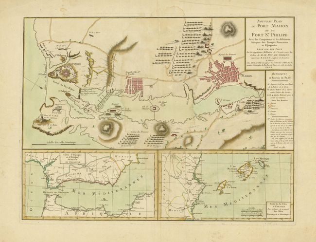
This interesting map illustrates Mahon Harbor on Minorca. One of the largest natural harbors in the world, it played an important role during the European wars of the eighteenth century. The British first gained control of Minorca in 1708, during the War of the Spanish Succession, and held the island until 1756, when it was captured by the French, during the Seven Years War. As part of the territorial settlement ending that war, in 1762, the island was restored to the British, and retained until 1782, when a joint Franco-Spanish expedition, under the command of Louis des Balbes de Berton de Crillon, forced the capitulation of St. Philip's Castle. It is that epic battle that is graphically illustrated on this sheet. Inset below the map are maps showing the relative locations of the Strait of Gibraltar and the Balearic Islands.
References: Mapforum.com, Vol. 8, Checklist of Charts of Mahon Harbour #77.
Condition: B+
Good impression and original color. Light damp stains in map and some stains and edge tears in the wide margins.