Catalog Archive
Auction 135, Lot 124

"Karte von l'Isle Royale Entworfen", Bellin, Jacques Nicolas

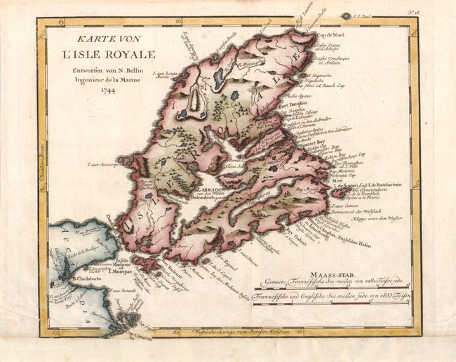
Subject: Canadian Maritimes

Period: 1756 (published)

Publication: Allegmeine Historie der Reisen zu Wasser und Lande

Color: Hand Color

Size:
10.5 x 9.3 inches
26.7 x 23.6 cm
Download High Resolution Image
(or just click on image to launch the Zoom viewer)

A strongly engraved map of Cape Breton Island and eastern Canada that includes topography and coastal place names. This is from a German edition of Charlevoix's Histoire et description générale de la Nouvelle France. Pierre Francois Xavier de Charlevoix was a Jesuit historian who explored Canada, the Great Lakes and the Mississippi River Valley.

References: Kershaw #863.

Condition: B+

Trimmed to neatline and remargined at bottom, else fine.

Estimate: $140 - $180

Sold for: $100

Closed on 2/16/2011

Archived