Subject: North America, Texas
Period: 1839-1845 (published)
Publication:
Color: Hand Color
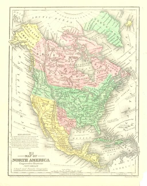
1) No. 3 Map of North America Engraved to Illustrate Mitchell's School and Family Geography, by S.A. Mitchell, from Mitchell's School and Family Geography, 1839, (7.8 x 10.3"). Nice map that shows a large Independent Republic of Texas extending to the 42nd parallel with a long stovepipe panhandle that incorporates Santa Fe. Austin is shown as the capital, and San Felipe and Bexar are located. Above Texas is the Great American Desert. The United States extends to the Pacific with Ft. George or Astoria, Ft. Colville, and Ft. Wallah-Wallah named. The Northwest extends well into Canada geographically showing the "Fifty-four Forty or Fight" dispute with Britain. Mexico controls California and the Southwest is Upper California with the Baja simply labeled California. Alaska is Russian America with the Aleutian Peninsula labeled Alaska. Cook's Inlet is well shown. Canada is depicted as British America and New Britain. States are not shown in the U.S. or Mexico. Numerous Indian tribes, major town, good detail of major rivers, and a vague idea of the Rocky Mountains are shown. The Great Basin is here called the Great Sandy Desert. This early edition has a blank verso. Dark impression and fine coloring. A little paper is missing in lower right margin tip. (A)
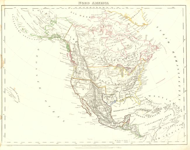
2) Nord America, by Carl Flemming, circa 1845, (16 x 12.2"). Nice map of the continent that features the Republic of Texas, with Alaska as Russisches Nord America, and Mexico controlling the Southwest. The Great Basin is unnamed and left blank. Extends to show all of the West Indies and the Sandwich Islands. A little marginal soiling and staining, image is near fine. (B+)
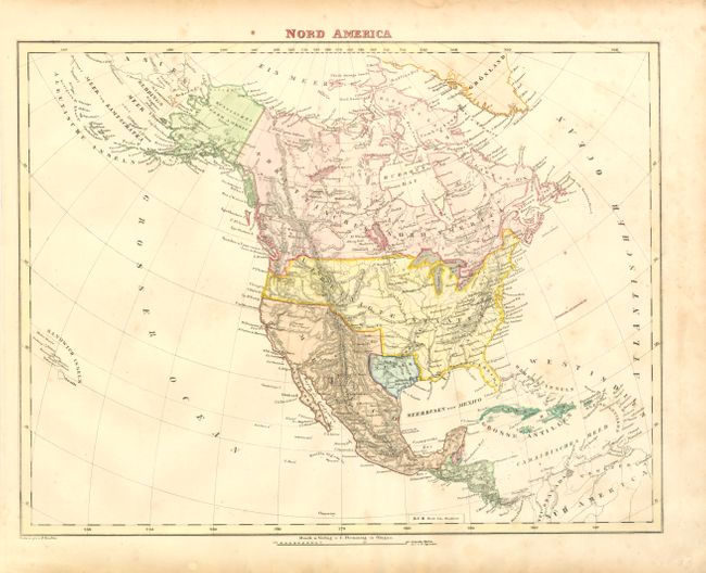
3) Nord America, by Carl Flemming, circa 1845, (15.8 x 12.4"). This map is virtually identical to the Flemming above. It is, however, fully colored and shows the western U.S./Canadian border dropping to the Columbia River, bowing to British claims in the border dispute known as "Fifty-Four Forty or Fight." A little more toning along right side, perhaps from flower pressing. (B+)
References:
Condition:
See individual descriptions.