Subject: Japan and Korea
Period: 1817 (circa)
Publication: Thomson's New General Atlas
Color: Hand Color
Size:
24.6 x 19.4 inches
62.5 x 49.3 cm
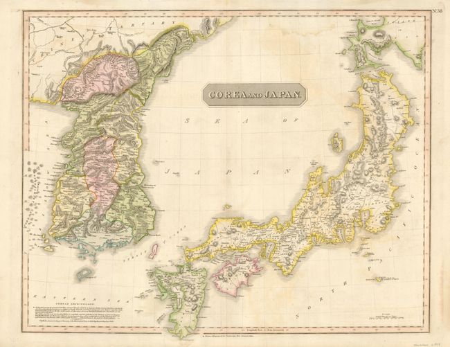
This large map of Japan and Korea shows the discoveries of Broughton and Krusenstern who traveled in the region in 1796-97 and 1805-11, respectively. In Japan, Kyrushu, Shikoku, and Awajishima are significantly more correct than early maps. Nicely detailed and colored by regions, it shows towns, roads, rivers, lakes and mountains. This is the second state with the Corean Archipelago added to the west of the Korean peninsula and a notation on the extend of these islands by Capt. Hall of the H.M.S. Alleeste, 1816.
References: cf Walter #128.
Condition: B+
Nice impression and original color with some faint damp stains and offsetting in map and a few edge tears in the blank margins.