Catalog Archive
Auction 134, Lot 134

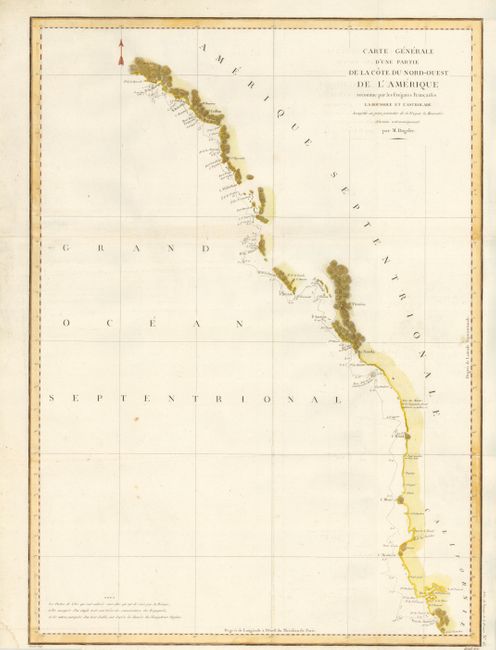
"Carte Generale d'une Partie de la Cote du Nord-Ouest de l'Amerique reconnue par les Fregates Francaises la Boussole et l'Astrolabe", La Perouse, Comte Jean F. Galoup, de
Subject: Western Canada & United States

Period: 1797 (published)

Publication: Atlas du Voyage de la Perouse

Color: Hand Color

Size:
19.5 x 27 inches
49.5 x 68.6 cm
Download High Resolution Image
(or just click on image to launch the Zoom viewer)

This is a superb large-scale map of the exploration of the West Coast of North America by La Perouse between June and September, 1786. The route begins at Mount St. Elias in Alaska on June 24 and finishes at Monterey California on September 12. The track of the ships with dates and other information is shown. Many coastal place names, but only those parts actually observed and surveyed are noted. Puget Sound and the Columbia River are conspicuously missing, this exploration taking place six years before the discovery of Puget Sound by Vancouver.

References: Falk #1797-8; Wagner (NW) #840.

Condition: B+

Near flawless example except for a few tiny spots in the blank Pacific and an area of paper weakness from paper making process at the extreme left edge. An exceptional example that is very nicely colored. Folding as issued.

Estimate: $250 - $300

Sold for: $275

Closed on 12/1/2010

Archived