Catalog Archive
Auction 131, Lot 60

"Carte de l'Hemisphere Austral Montrant les Routes des Navigateurs les plus Celebres par le Capitaine Jacques Cook", Cook, James (Capt.)

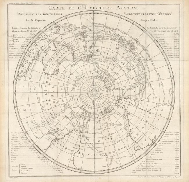
Subject: Southern Hemisphere

Period: 1775 (circa)

Publication: Abrege de l'Histoire Generale des Voyages

Color: Black & White

Size:
21 x 21 inches
53.3 x 53.3 cm
Download High Resolution Image
(or just click on image to launch the Zoom viewer)

This scarce chart is a French edition of Cook's voyage in the southern hemisphere that is drawn in a circular polar-projection. Lists beside the map provide details of discoveries and destinations in the southern hemisphere. The chart includes the routes of other explorers including Tasman, Dampierre, Carteret, Byron, Bougainville, Furneaux and others. The copper-engraved chart shows all of Australia (Nouvelle Hollande) with Tasmania attached to the mainland. There is good detail of the East Indies and the Celebes. An important chart for any collector of Antarctic material.

References:

Condition: A

Issued folded, now mostly flattened. The map is mostly clean and bright with just a little fold abrasion or soiling.

Estimate: $400 - $500

Sold for: $300

Closed on 3/17/2010

Archived