Subject: Panama and Northern South America
Period: 1821 (dated)
Publication: Neptune Francois
Color: Black & White
Size:
22 x 33.5 inches
55.9 x 85.1 cm
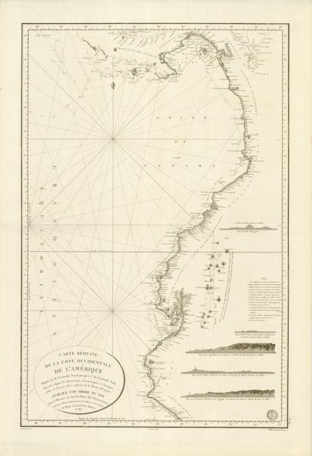
A superb chart covering the Pacific coastline from Panama to Puerto Eten, Peru. The region between Quito and Cuenca in Ecuador shows the survey conducted by the Spanish-French Geodesic Mission for the purpose of measuring the roundness of the earth and measuring the length of a degree of longitude at the equator. The mission was the first major international scientific expedition and their measurements enabled the first accurate determination of the size of the earth and led to the establishment of the international metric system of measurement. There are several inset coastal approach views and a key to the various symbols used. The map is based on Spanish marine charts issued in the early 1800s and shows the Malaspina Expedition tracks (1789-94) along the coastline. Drawn by Besancon and engraved by Vicq. The seal of the Depot de la Marine is in the lower right corner with Prix Quartre Francs below the neatline.
References:
Condition: A+