Catalog Archive
Auction 131, Lot 142

"Karte von der Insel Montreal und den Gegenden Umher…", Bellin, Jacques Nicolas

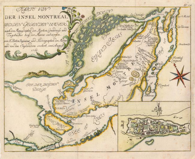
Subject: Montreal, Canada

Period: 1760 (dated)

Publication:

Color: Hand Color

Size:
11.2 x 9.6 inches
28.4 x 24.4 cm
Download High Resolution Image
(or just click on image to launch the Zoom viewer)

This is a German version of Bellin's map of the islands of Montreal and Jesus in great detail. Montreal (here Stadt Maria) is depicted as a walled and fortified city. Forts Karen Spitze, Se. Annen, Senneville, Se. Geneviere, Roland, la Chine, etc. are located; as are the surrounding islands of Se. Therese, Ronde, Se. Helen, Perot and Bizard. This is the second state, published by Korn in 1776, with the additional inset plan of Montreal based on Thomas Jefferys important plan of the city.

References: Kershaw #1107.

Condition: B+

Issued folded, now flattened, with a tissue repaired on a fold intersection and a bit of light foxing.

Estimate: $240 - $300

Sold for: $210

Closed on 3/17/2010

Archived