Subject: North America
Period: 1794 (dated)
Publication:
Color: Hand Color
Size:
18.3 x 14.3 inches
46.5 x 36.3 cm
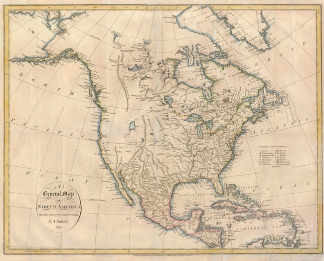
John Russell introduced an entirely new feature to the topography of North America with this map by showing a long range of Stony Mountains in the west. At the northern tip of the mountain range are Mountains with bright stones with the discoveries of Hearne and Mackenzie shown in the Arctic. A large lake occupies the space where the Great Salt Lake actually lies, and the headwaters of the Colorado, Rio Grande, and Missouri rivers appear in close proximity to each other. Juan de Fonca's Inlet appears in the general vicinity of Seattle and there is no Vancouver Island. The United States are confined east of the Mississippi where 15 states are identified. Maine is not named and is given a very squat shape. Russell's map was copied by Reid the following year and influenced several other mapmakers of the period.
References: Wheat [TMW] #228.
Condition: B
Issued folded, now flattened, with tissue reinforced folds on verso. A 2" binding tear has been repaired at right.