Subject: California
Period: 1847 (dated)
Publication:
Color: Black & White
This lot of Mexican-American War maps includes the following titles:
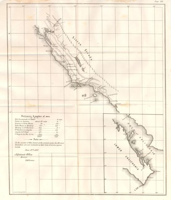
1) [untitled - Adjutant's Office California coast], U.S. War Department, 1847, (12 x 14.5"), Senate Ex. Doc. 1, 30th Congress, 1st Session. This untitled Mexican-American War map shows the southern California coast. It names San Diego, Capistrano, San Gabriel, Angeles, Monterey, and Santa Clara. A road extends from San Diego north to the San Francisco peninsula then to Sonoma and ends at Sutter's Mill (Suters) where gold would be discovered the following year. A table gives the distance between major posts and the number of soldiers posted at each. The troops of the Mormon Battalion are not included "as their term of service expires in July." Dated June 19, 1847 and signed in the plate, "Adjutant's Office, Monterey, California." Large inset details the Baja from C. San Lucas up to Loreto, locating La Paz and shows Guaymas on the mainland. An uncommon issue printed by the P.S. Duval company of Philadelphia. A few small and light foxing or stains, else a fine example. (B+)
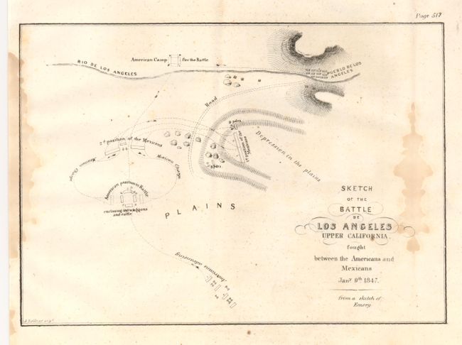
2) Sketch of the Battle of Los Angeles Upper California fought between the Americans and Mexicans Jany. 9th 1847. (8.3 x 5.8") This historically significant Mexican-American War map locates the Pueblo de Los Angeles, the Rio de Los Angeles, and the positions of forces during this battle, which resulted in the surrender of the Mexican forces and the United States acquiring all of the Southwest. Light but long water stain along fold at right in blank area. (B+)
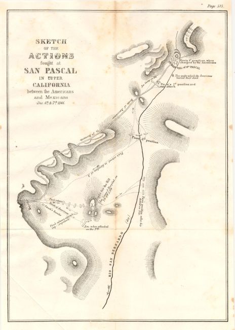
3) Sketch of the Actions fought at San Pascal in Upper California between the Americans and Mexicans Dec. 6th & 7th 1846. This map shows in great detail the troop positions. It locates the San Bernardo River, the road to San Bernardo, and the Indian Village of San Pascal. Pico's various positions and attacks are highlighted. A little light toning in upper portion. (B+) (7.8 x 11")
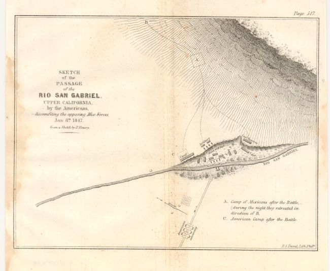
4) Sketch of the Passage of the Rio San Gabriel, Upper California, by the Americans, discomfiting the opposing Mex. Forces, Jan. 8th 1847. (8 x 6.3"). Shows army positions and encampments along and near the San Gabriel River. A little light staining at left and right borders and some speckling along centerfold. (B+)
References:
Condition:
See individual descriptions.