Subject: Western Hemisphere
Period: 1601 (published)
Publication: Historia General
Color: Hand Color
Size:
12.8 x 9 inches
32.5 x 22.9 cm
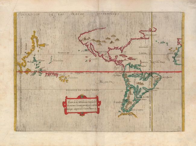
This is the scarce, original edition of Antonio de Herrera y Tordesillas important map of the Americas that he prepared as the official historian of Castile and the Indies. He compiled a history of the Spanish conquests and early explorations in the Americas, that included this simple, but elegantly engraved map of the Americas and the Pacific extending to the Spanish interests in the Philippines. North America is truncated with a peninsular California and the Sierra Nevadas comprise the northern coast. The Amazon and the Plata are the major features of South America and a large, partially formed Tierra del Fuego is depicted. The map includes the Pacific Ocean with the Spanish possessions. Korea appears as an island off the east coast of Asia. The map is largely derived from the manuscript charts of Juan Lopez de Velasco. The lines of Spanish-Portuguese demarcation are shown, dividing the non-Christian world into spheres of influence. This scarce edition was only published once.
References: Burden #140.
Condition: B
Repaired along the centerfold with some restoration of paper loss - still an attractive example of a very scarce map.