Subject: North America
Period: 1750 (dated)
Publication: Methode Abregee et facile pour apprendre la Geographie
Color: Black & White
Size:
6 x 6 inches
15.2 x 15.2 cm
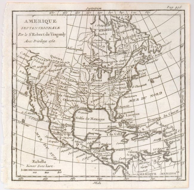
The western part of North America is labeled Nle. Albion with Quivira above and Teguaio in the area of today's Utah. The entire Northwest coast above Albion is blank and partially hidden by the square cartouche. There is an open-ended bay in Hudson Bay allowing for the possibility of the Northwest Passage. Apaches are correctly located in the Southwest, and Texas is named Cenis and is a part of Spanish Floride, which incongruently does not include Florida. The British Colonies are shown along the eastern seaboard, with the large French possessions of Louisiane to the west. Dated 1750, but probably published about 1775. This map carries page 496 rather than 482 so is from a later edition of the atlas.
References: Pedley #447.
Condition: A+
Clear example with good impression.