Subject: North America
Period: 1836-1840 (circa)
Publication:
Color: Hand Color
Interesting pair of maps of North America during the mid-19th century.
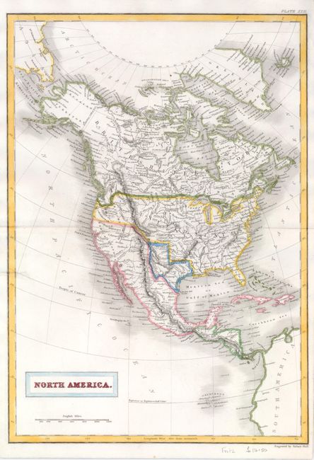
1) North America Plate by Sidney Hall, circa 1840 features the Independent Republic of Texas with the panhandle bounded on the Arkansas River. The map extends to include the Galapagos, Cuba, Jamaica, St. Domingo, and all of Central America. As a British mapmaker, Hall extends Canada well south to the Columbia River in the Pacific Northwest, showing British claims in that area. Alaska is still Russian Territory and Mexico occupies California and the Southwest. The states and provinces are not delineated, but some regions are labeled including Western Territory in the area of present-day British Columbia, Washington and Oregon. Hand colored (10.3 x 14.6").
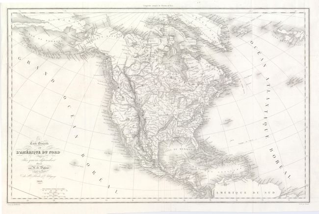
2) Carte Generale de L'Amerique du Nord by Adolphe Hippolyte Dufour is a delicately engraved, uncolored map of the continent in 1836, showing Oregon Territory (Territoire Oregon) reaching to present-day Nebraska, while Mexico controls the entire southwest, including Texas. (19.6 x 12.5")
References:
Condition: B+
Map 1 with the centerfold reinforced and a repaired tear just into the left of the map with a tiny amount of facsimile on the Tropic of Cancer. Map 2 is fine.