Catalog Archive
Auction 120, Lot 131

"Plan de la Ville et du Port de Louisbourg Leve en 1756…", Depot de la Marine

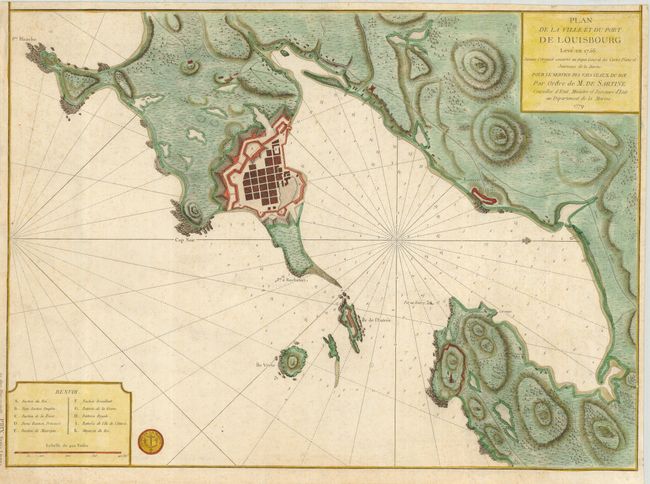
Subject: Canada, Louisbourg, Cape Breton

Period: 1779 (dated)

Publication:

Color: Hand Color

Size:
23 x 16.6 inches
58.4 x 42.2 cm
Download High Resolution Image
(or just click on image to launch the Zoom viewer)

Lovely chart of the fortified town and coast of Louisbourg showing it as it was during the French and Indian War. The map presents soundings and navigational hazards, and it is oriented with north to the right. A table to the left includes a lettered key to important buildings in the area. Third state with the stamp of the Depot de la Marine, and les deus Plans ensemble. Prix Trois Livres outside of the left neatline.

References: Sellers & Van Ee #341; Kershaw #938.

Condition: B

On a sturdy sheet with trimmed margins, still sufficient for framing. A bit of very light foxing.

Estimate: $700 - $900

Sold for: $650

Closed on 7/18/2007

Archived