Subject: Europe
Period: 1799 (published)
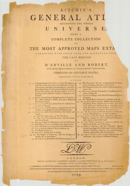
Publication: General Atlas Describing the Whole Universe…
Color: Hand Color
Group of large maps from this nice English atlas published by Laurie and Whittle. Each map is filled with excellent detail and extensive notations and keys. Lot includes a partial title page. Several maps are still partially bound.
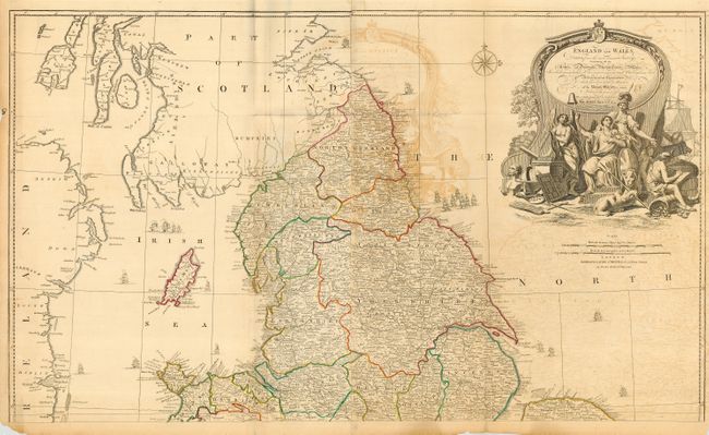
1) EnEngland and Wales, drawn from the most accurate surveysby John Rocque (39 x 23") Couple of short tears just entering map.
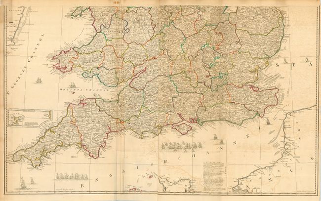
2) [England and Wales, southern portion] (38.5 x 23.4")
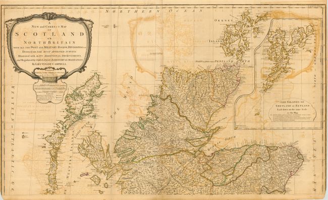
3) A New and Correct Map of Scotland or North Britain… By Lieutenant Campbell. [Northern portion] (41.5 x 24.5")
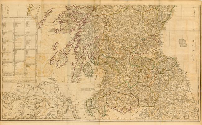
4) [Scotland, southern portion] (41.3 x 24.3") Slight loss of neatline in bottom corners.
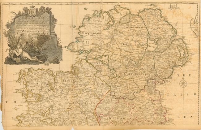
5) A Map of the Kingdom of Ireland divided into Provinces, Counties and Baronies… [northern portion] (38 x 23.5") Small loss in left border.
6) [Ireland, southern portion] (38 x 24.5") Tears along fold without loss.
7) A New Map of the Seat of War in the Netherlands (25.5 18.7")
8) Seat of War in the Seven United Provinces Comprehending Holland, Zeeland, Utrecht, Gelders, Over-Yssel, Frieseland, and Groningen (22.5 x 18.5")
9) A New Map of the Kingdom of France Divided into its Governments with All the Post Roads (23 x 18.2")
10) A New Map of France Divided into Eighty-Three Departments According to the Decree of the National Assembly in 1790 (22.3 x 19")
11) A New Map of the Kingdoms of Spain and Portugal with their Principal Divisions (25.3 x 18.3")
12) A New Map of Italy with the Islands of Sicily, Sardinia & Corsica (19.8 x 23")
13) A New Map of the Island of Corsica, by Thomas Jefferys (19 x 24.8")
14) A New Map of Germany Divided into its Circles (26.2 x 18.6")
15) [The Kingdom of Germany, with the Kingdom of Prussia, &c., southern portion] (47 x 20.2")
16) A New Map of Switzerland Divided into the Thirteen Cantones with Their Allies & Their Subjects (25.5 x 19.2)
17) A New Map of the Northern States containing the Kingdoms of Sweden, Denmark and Norway; with the Western Part of Russia, Livonia, Courland, &c. (25 x 18.3")
18) A New Map of the Kingdom of Poland, with its Dismembered Provinces and the Kingdm. of Prussia (25.5 x 18.8")
19) Kingdom of Hungary, Principality of Transilvania, Sclavonia, Croatia, with a Part of Valakia, Bulgaria, Bosnia and Servia… (21 x 18.5")
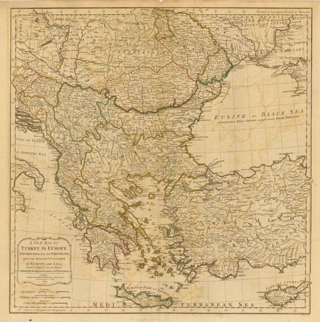
20) A New Map of Turkey in Europe … with the Adjacent Countries in Europe and Asia. (23.5 x 24")
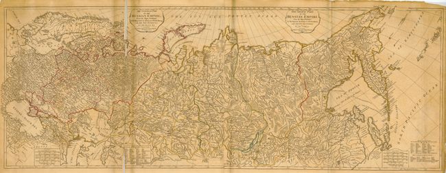
21) The European Part / The Asiatic Part of the Russian Empire… (50 x 18.7")
References:
Condition: D
Original outline color. All would greatly benefit from simple, but professional cleaning and repair. All toned and soiled with some offsetting, fold separations, and chipped margins. Other defects are mention in the description.