Subject: North America
Period: 1855 (dated)
Publication:
Color: Hand Color
Size:
11.5 x 17 inches
29.2 x 43.2 cm
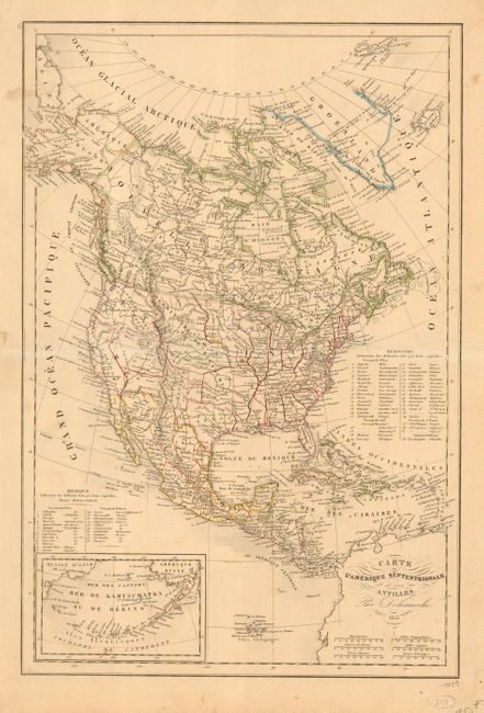
This attractive map of the continent displays early western territorial borders. The District of Oregon includes all of present day Washington, Oregon, Idaho and parts of Montana and Wyoming. The New Mexico Territory has a long tail that extends north following the Rio Grande well into today's Colorado. Utah is a large and unnamed region. The Minnesota Territory is large and includes the Dakota area, all of which is within the District des Sioux. The map is filled with the locations of many Indian Districts and Tribes. A key lists 38 states and the territories and another list locates 23 states of Mexico. Inset of "Mer de Kamtschatka ou de Bering" shows the Aleutian Islands extending from Amerique Russe. A fancy script lettered title and distance scales in six different units fill the corner of South America.
References:
Condition: B
Overall toned with color somewhat faded. Full margins with short marginal split along centerfold at left.