Subject: Scotland
Period: 1588 (published)
Publication: Mariners Mirrour
Color: Hand Color
Size:
20.2 x 12.7 inches
51.3 x 32.3 cm
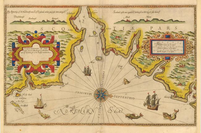
Superb sea chart covering the coastline and approaches to Edinburgh. The map is from the very rare English text edition of the Spieghel der Zeevaerdt, the first detailed atlas of charts covering the coastlines of Europe. It was translated into English by Anthony Ashley, clerk of the Privy Council, who used the Latin edition of 1586 as a model. The charts are renowned for their fine engraving by the best craftsmen of the period including Theodore de Bry and the Doetecum brothers. This map is beautifully adorned with two large strapwork cartouches, a central compass rose, numerous sea monsters and sailing ships. The land is filled with forests, mountains and farms, and coastal prospectives are included at top.
References:
Condition: C
Sharp impression, printed on sturdy paper with lovely old color. Old repairs on centerfold and pair of short tears (with minor loss) at sides with side margins extended. Presentable as is, but would benefit from the care of a professional conservator.