Subject: Atlantic Islands - Bermuda
Period: 1696 (circa)
Publication:
Color: Black & White
Size:
24.6 x 18.2 inches
62.5 x 46.2 cm
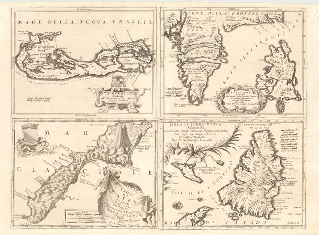
Four maps printed on one large sheet; each from a separate copper plate. First is a fine map of Bermuda with the title cartouche incorporating a coat of arms. Second is a map of the mythical island of Frislanda, which was purportedly discovered by the Zeno brothers in a 14th century voyage into the North Atlantic. The map also includes the southern part of Greenland in the old format with two large islands forming its southern tip. Next is a map of Jan Mayen Island, which was discovered in 1614 by a Dutch whaling captain, northeast of Iceland. Last is a nice map of Newfoundland reduced from Coronelli's larger map of the Maritimes.
References: Bermuda - MCC-18 (Palmer) #19; Newfoundland - Kershaw #164.
Condition: A
Worm tracks along centerfold have been professionally infilled with skilled facsimile of a few neatlines.