Catalog Archive
Auction 111, Lot 297

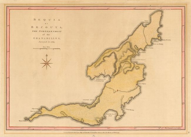
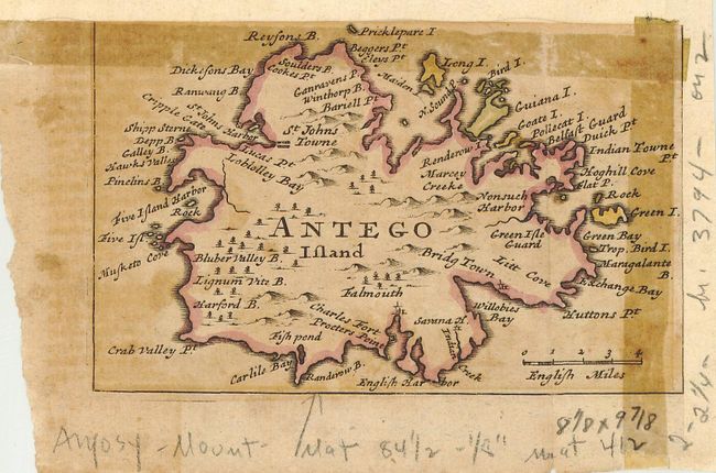
"[Lot of 2] Bequia or Becouya, The Northernmost of the Granadilles, surveyed in 1763 [and] Antego Island",

Subject: Lesser Antilles

Period:

Publication:

Color: Hand Color

Size:
See Description
Download High Resolution Image
(or just click on image to launch the Zoom viewer)

First (18.2 x 12.6") is an uncommon map of this island in the Grenadines showing a few buildings and fortifications, roads and harbors. The map was drawn by Thomas Jefferys and published by Robert Sayer in 1775. The second map (5.2 x 3.2") of Antigua has been trimmed from a larger map, probably by Herman Moll, circa 1740.

References: Bequia - Sellers & Van Ee #2096.

Condition:

Original color is a bit faded. First is overall good condition with mat burn in margin. Margins have been trimmed. Second is in poor condition with tape burn on two sides, trimmed on two sides, with extensive pencil notations in margins.

Estimate: $100 - $150

Sold for: $75

Closed on 6/8/2005

Archived