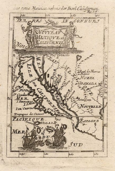
Subject: Southwestern United States and Mexico
Period: 1684 (published)
Publication: Beschreibun des ganzen welt-kreisses…
Color: Black & White
Size:
4 x 5.6 inches
10.2 x 14.2 cm
This is one of the most attractive miniature maps from this series. The map focuses on the island of California and the southwestern United States and Mexico. California has a flat northern coast with C. Blanco the northernmost place name. Four islands lie between California and the mainland; the largest is named Gigante I. The Norto R. (Rio Grande) flows from a large interior lake, with Real de Nueva Mexico (Santa Fe) located on its bank, and empties incorrectly into the Gulf of California. The title cartouche is flanked by two native figures and two ships are engaged in battle in the lower part of the map. Second state from a German edition.
References: McLaughlin #87.
Condition: A
Overall very good except the impression is a bit uneven. Remnants of hinge tape on verso.


