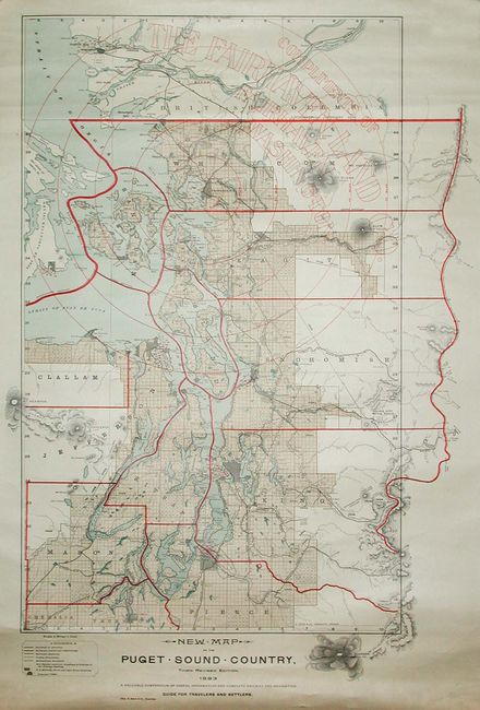
Subject: Washington
Period: 1893 (dated)
Publication:
Color: Printed Color
Size:
20 x 30 inches
50.8 x 76.2 cm
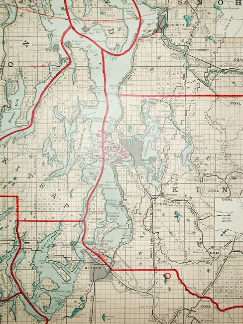
A detailed wall map of the vicinity of Puget Sound drawn on a scale of 6 miles to the inch. This colorful map extends to Stevens Pass and the Boston Mine in the east, and south to include Olympia and Mt. Rainier, which is drawn outside the map's neatline. A table of references identifies principal cities, county and international boundaries, numerous railways, soundings in fathoms in the harbors, U.S. military naval and lighthouse reserves. Red overprinting shows the distance from Fairhaven in 10 mile increments. Also in red overprinting is "Complements of the Fairhaven Land Co. Fairhaven Washington." Below the title, the intended purpose of the map is noted: "A Valuable Compendium of Useful Information and Complete Railway and Navigation Guide for Travellers and Settlers." A remarkable advertising map issued to promote settlement, development and tourism. Fairhaven was founded in the 1880s and was a busy port city by the 1890s. The town has since been absorbed by Bellingham, leaving only a park named after the once thriving port city. A rare advertising issue compiled by Charles H. Baker.
References:
Condition: A
Clean, bright example with fine coloring. Backed with original linen and edge piping present. Some short marginal tears not affecting map. Top roller missing, lower roller attached. Near fine.