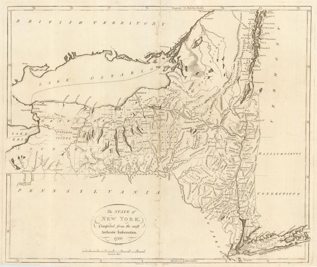
Subject: New York
Period: 1796 (dated)
Publication: American Atlas
Color: Black & White
Size:
17.9 x 15.1 inches
45.5 x 38.4 cm
A rare map from the second atlas printed in America. It is based on Samuel Lewis' map of 1795. The Niagara Road is shown across the entire state. The 3 Trees are named and graphically depicted at the westernmost corner of Connecticut. Another early survey marker, The Painted Post, is graphically shown in the eastern portion of the Genesee Country that is divided into ranges and townships. There are numerous land purchases and grants, as well as the counties, townships and settlements. Engraved by D. Martin.
References: Phillips (A) 1216-10; Wheat & Brun #371.
Condition: B
Good impression on fine hand laid paper with large watermark of a crown and fleur-de-lis. Some areas of weakness along centerfold, professionally closed on verso. One small area of paper weakness in blank area to right.