Subject: United States - Northwestern
Period: 1887 (dated)
Publication:
Color: Printed Color
Size:
31.5 x 31.5 inches
80 x 80 cm
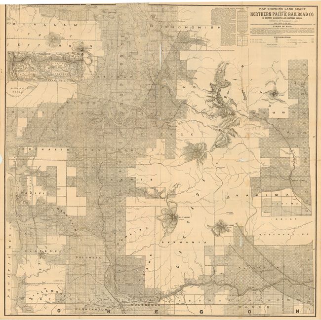
Large, remarkably detailed map that shows all of Puget Sound and the mouth of the Columbia River and extends east to beyond North Yakima. Includes the cities of Port Angles, Port Townsend, Seattle, Olympia, Astoria, Portland, etc. This map was issued in conjunction with a land sale, the terms of which are included on the map. Land prices ranged between $2.60 - $6.00 per acre with five or ten year terms at 7% interest. Timber land was available for cash. On the verso is text related to the area and the sale, numerous engraved city views (Seattle, Tacoma, Walla Walla, Spokane Falls, Dayton, North Yakima, etc.), a map of Washington and Oregon, and more.
References: cf Rumsey 5392B.
Condition: C
Map is generally very good with pleasant age toning. Several splits at fold intersections and two clean tears in body of map. A rare issue that will benefit from professional conservation. Our image cuts off top border in error - all margins exists.