Subject: Asia - Northern
Period: 1653 (circa)
Publication: Nuevo Atlas…
Color: Hand Color
Size:
19.2 x 15 inches
48.8 x 38.1 cm
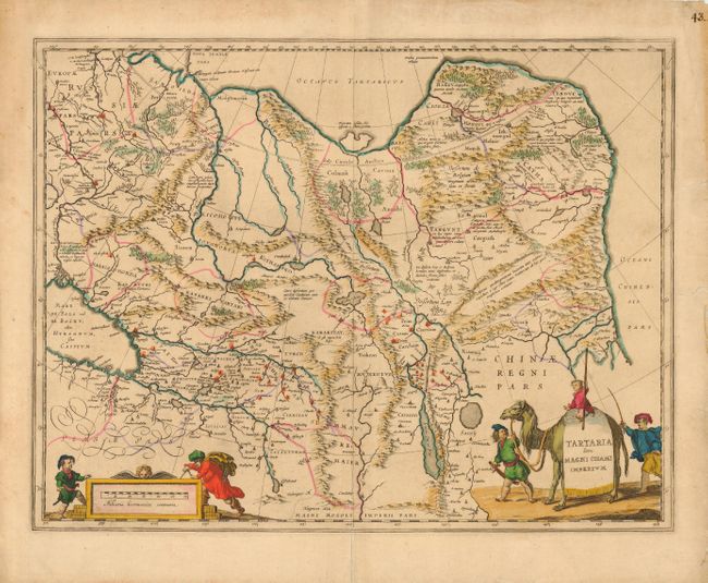
Fine map of Tartary and northern China illustrating the knowledge obtained by the English and Dutch explorers as far as the Ob River with the balance of the map based on the reports of Marco Polo and the Greek classics. The deserts are filled with a wild assortment of devils and dragons, being held at bay from China by the Great Wall. Explorers flank the distance scale and the title is symbolically engraved onto the saddle blanket of a camel, representing the trade over the Silk Road. This map is nearly identical to Bleau's map of the same title. No text on verso.
References:
Condition: B
Light even toning and a few tiny tears with old repairs in margins, one just enters neatline on right side.