Subject: Canada
Period: 1756 (published)
Publication: Allegmeine Historie der Reisen zu Wasser und zu Lande
Color: Black & White
Size:
11 x 7.5 inches
27.9 x 19.1 cm
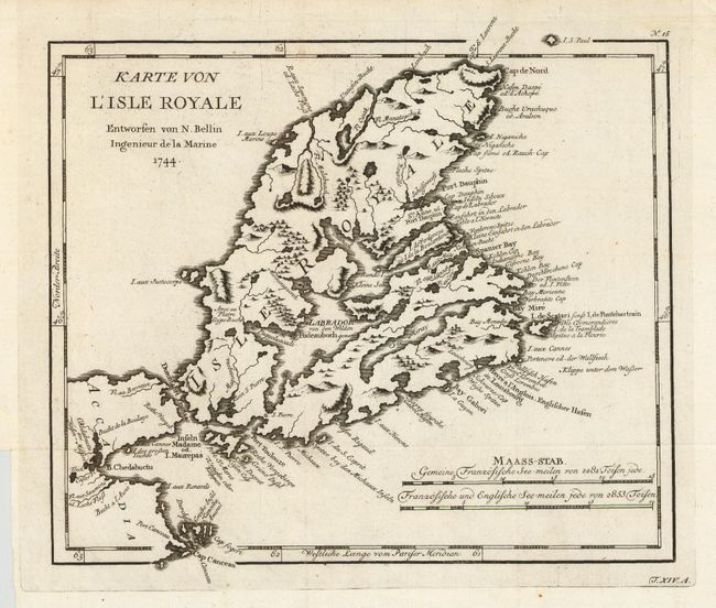
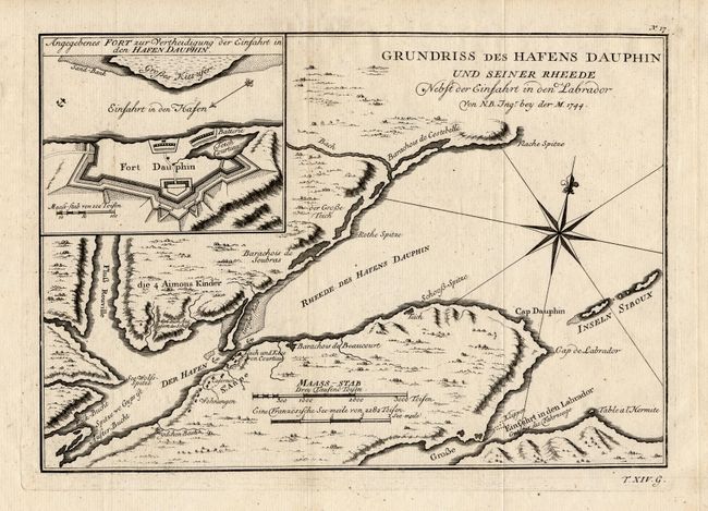
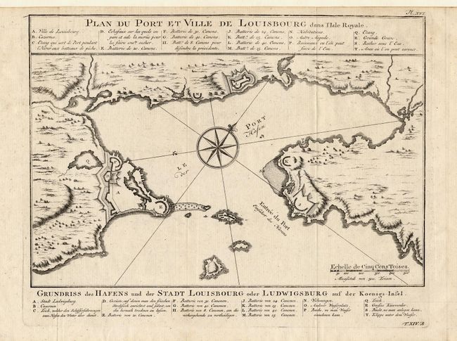
Three fine copper engraved charts focusing on Cape Breton Island - here called l'Isle Royale. War broke out between France and England in 1744 and a large number of maps were produced to describe the areas involved. The French lost Louisbourg to a determined British army, but the treaty of Aix-la-Chappelle returned Louisbourg to the French. By 1758 Louisbourg was once again attacked by the British. All dated 1744, but published in 1756 in the German edition by Arkstee & Merkus.
1) The first shows the entire island with much detail along the eastern coast. Shows topography and watershed. Two distance scales. A fine general map of the island. 10.5" x 9.4".
2) The second map shows the harbor of Louisbourg in the southeast portion of the island in great detail. Large compass rose and fleur-de-lis in the harbor. German title below: "Grundriss des Hafens und der Stadt Louisbourg oder Ludwigsburg auf der Koenigs-Insel." 11.0" x 7.5".
3) The third map details St. Anns Bay on Cape Breton Island. Locates the walled fort Dauphin (today's Englishtown) on the southern shore. Inset of "Angegebenes Fort zur Vertheidigung der Einfahrt in den Hafen Dauphin" details the fort and it's battery. Handsome chart with two distance scales and compass rose with fleur-de-lis. 11.0" x 7.5".
References: 1) Kershaw #863; 2) cf Kershaw #884 & MCC 96, No. 708; 3) cf Kershaw #878.
Condition: A+
Fine impressions on clean, hand laid paper. First two with especially crisp, dark impressions.