Subject: Asia
Period: 1719 (circa)
Publication:
Color: Hand Color
Size:
22.7 x 19.5 inches
57.7 x 49.5 cm
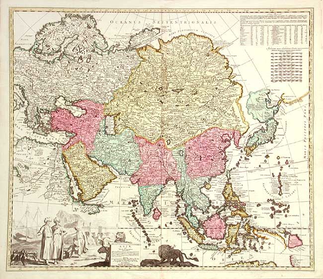
Scarce and very decorative map of Asia based largely on Johann Homman's 1712 map of the continent. Zurner produced maps for both Homann and Schenk, as well publishing his own maps. The northeast coastline is shown with Witsen's information on Siberia. Hokkaido and Honshu (Terra Yedso) are joined together by a narrow isthmus and separated from the mainland by a wide straight. An accompanying note acknowledges Scherer as the source, although the orientation of Yedso and Companies Land appears to be based on the Delisle model. A huge lake appears in Tibet and is named the legendary Chiamay. A second lake is shown in the position usually occupied by Lake Chiamay, but here it is named L. Cananor Cimabete. In Southeast Asia the straits between New Guinea and Australia appear in a tentative fashion, noting Dampier's Strait and a disembodied Carpenteria with no definite northern limit. The map is decorated with a large, uncolored cartouche featuring Arab merchants, a fort, a pair of leopards and a fierce lion.
References: Yeo #116.
Condition: A+
Fine impression and original color. Couple of tiny spots, still overall very fine.