Subject: Washington
Period: 1862 (dated)
Publication:
Color: Black & White
Size:
35 x 17 inches
88.9 x 43.2 cm
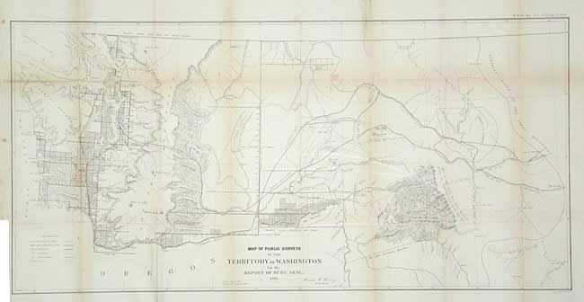
In 1860 the non-Indian population was only 11,594 and this fine map shows the location of executed surveys reflecting the approximate locations of these settlers. It is one of the few GLO maps to include Idaho and part of Wyoming - then within the territory's boundaries. Gold discoveries in Idaho will result in the spinning off of the Idaho Mining district in 1863. Remarkable detail for a map of this period with many place names, watershed detail, and hachured mountains. Steven's proposed railroad route is shown, as is the Continental Divide. Created by Anson G. Henry, the Survey General, in Olympia.
References:
Condition: B
Backed with archival tissue to support and close a fold weakness and one tear.