Catalog Archive
Auction 103, Lot 78

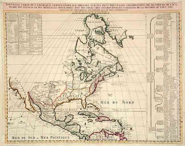
"Nouvelle Carte de l'Amerique Septentrionale dressee sur les plus Nouvelles Observations de Messieurs de l'Academie des Sciences et des Meilleurs Geographes avec des tables tres instructives et curieuses de la division de tous les Etats…", Chatelain, Henry Abraham
Subject: North America

Period: 1720 (circa)

Publication: Atlas Historique…

Color: Hand Color

Size:
18.2 x 17 inches
46.2 x 43.2 cm
Download High Resolution Image
(or just click on image to launch the Zoom viewer)

Great map of North America with well developed cartography in the Great Lakes and Mississippi River. It includes all of Central America and the West Indies. The English settlements are confined to the eastern seaboard. The mythical kingdom of Quivra is located just west of the Mississippi River and the city of Cibola are located in New Mexico. The possible insularity of California is left undecided with a small gap portrayed between the mainland and Baja. The routes of early discoverers are depicted along the Pacific coast. The west is left entirely blank and is partially filled with a table of information on the West Indies. Another table fills a panel at right with information concerning the indigenous people and colonial possessions on the continent.

References: Lowery #263; Phillips (A) 579.

Condition: A

Crisp and clean with nice original color. Couple of tissue and archival tape repairs on folds, lower left corner and one area of paper thinness in a blank area of the map.

Estimate: $900 - $1,100

Sold for: $800

Closed on 6/11/2003

Archived