Showing Featured Lots(remove filter)
Filtered by Category:Canada(Show All Categories)
Current Auction
4 lots
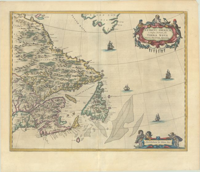
Lot 86
Subject: Eastern Canada
Blaeu, Johannes
Extrema Americae Versus Boream, ubi Terra Nova Nova Francia, Adjacentiaq, 1663
Size: 22.4 x 17.7 inches (56.9 x 45 cm)
Estimate: $1,800 - $2,100
Blaeu's Only Map of Canada, Showing the Canadian Maritimes
Sold for: $1,300
Closed on 6/18/2025
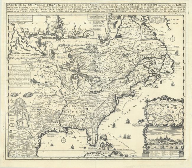
Lot 95
Subject: Colonial Eastern United States & Canada
Chatelain, Henry Abraham
Carte de la Nouvelle France, ou se Voit le Cours des Grandes Rivieres de S. Laurens & de Mississipi Aujour d'hui S. Louis, aux Environs des-quelles se Trouvent les Etats, Pais, Nations, Peuples, &c. de la Floride, de la Louisiane, de la Virginie..., 1719
Size: 19.3 x 16.7 inches (49 x 42.4 cm)
Estimate: $2,200 - $2,500
One of the Most Informative 18th Century Maps of the French Possessions in North America
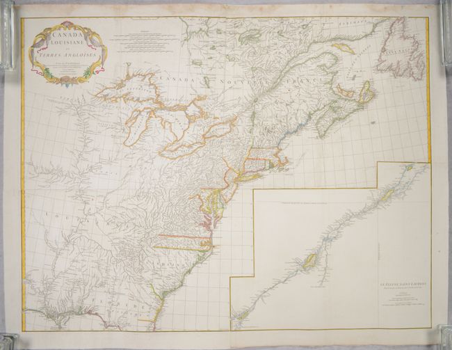
Lot 96
Subject: Colonial Eastern United States & Canada
Anville, Jean Baptiste Bourguignon d'
[On 4 Joined Sheets] Canada Louisiane et Terres Angloises, 1755
Size: 44.8 x 33.9 inches (113.8 x 86.1 cm)
Estimate: $1,400 - $1,700
D'Anville's Spectacular Map of Eastern Seaboard on 4 Joined Sheets
Sold for: $1,000
Closed on 6/18/2025
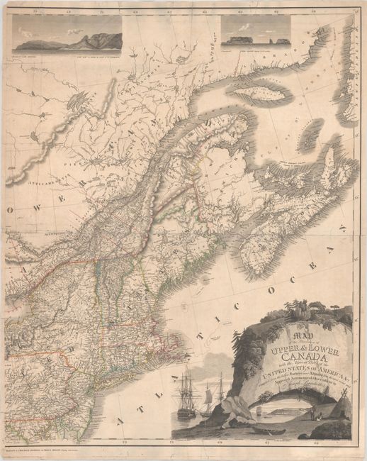
Lot 104
Subject: Northeastern United States & Canada
Bouchette, Joseph
[Eastern Sheet] Map of the Provinces of Upper & Lower Canada with the Adjacent Parts of the United States of America &c. Compiled from the Latest Surveys and Adjusted from the Most Recent and Approved Astronomical Observations, 1815
Size: 24.3 x 30 inches (61.7 x 76.2 cm)
Estimate: $2,400 - $3,000
Eastern Sheet of Bouchette's Rare Map Presenting Lower Canada and New England
4 lots