Showing Featured Lots(remove filter)
Filtered by Category:United States(Show All Categories)
Showing results for:Auction 132
Catalog Archive
12 lots
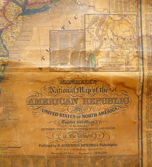
Auction 132, Lot 152
Subject: Eastern United States, Texas
Mitchell, Samuel Augustus
Mitchell's National Map of the American Republic or United States of North America, Together with Maps of the Vicinities of Thirty-Two of the Principal Cities and Towns in the Union, 1843
Size: 47 x 38 inches (119.4 x 96.5 cm)
Estimate: $800 - $1,000
Sold for: $800
Closed on 6/2/2010
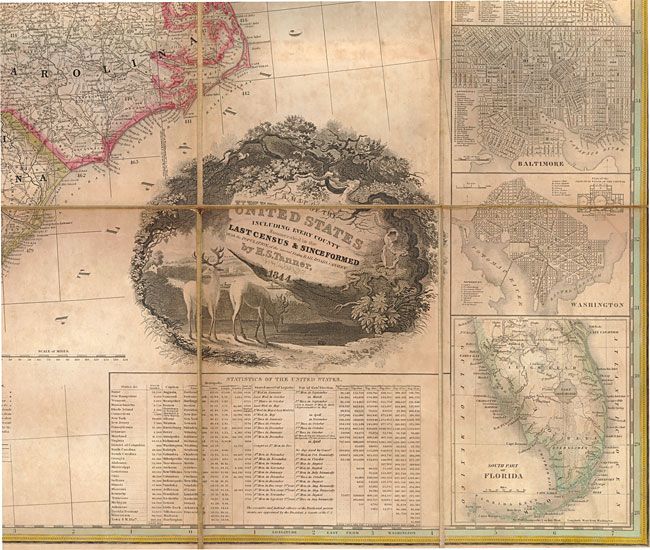
Auction 132, Lot 153
Subject: Eastern United States, Texas
Tanner, Henry Schenck
A Map of the United States Including Every County Enumerated in the Last Census & Since Formed with Population, of the several States, Railroads Canals &c., 1844
Size: 60.5 x 45.8 inches (153.7 x 116.3 cm)
Estimate: $13,000 - $18,000
Sold for: $9,500
Closed on 6/2/2010
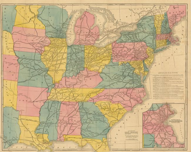
Auction 132, Lot 154
Subject: Eastern United States
Dinsmore's Pocket War Map, 1861
Size: 24.4 x 19 inches (62 x 48.3 cm)
Estimate: $400 - $600
Sold for: $240
Closed on 6/2/2010
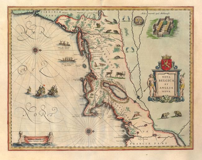
Auction 132, Lot 163
Subject: Colonial New England and Mid Atlantic
Blaeu, Willem
Nova Belgica et Anglia Nova, 1635
Size: 19.8 x 15.3 inches (50.3 x 38.9 cm)
Estimate: $2,750 - $3,500
Sold for: $2,500
Closed on 6/2/2010
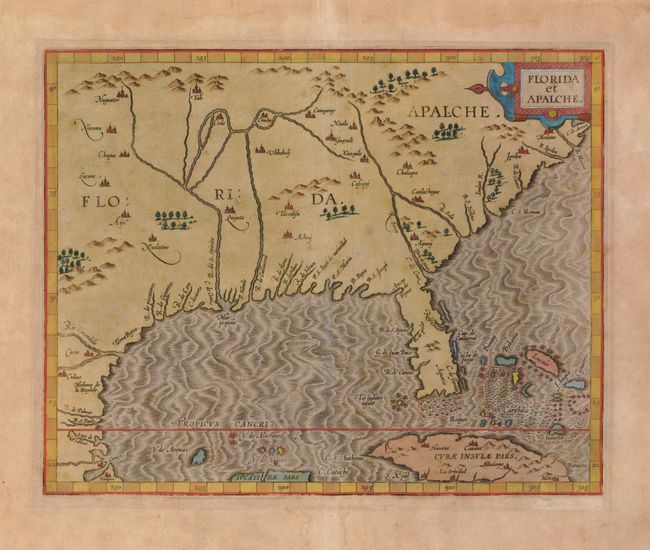
Auction 132, Lot 177
Subject: Colonial Southern United States
Wytfliet, Cornelis
Florida et Apalche, 1597
Size: 11.3 x 9 inches (28.7 x 22.9 cm)
Estimate: $2,750 - $3,500
Unsold
Closed on 6/2/2010
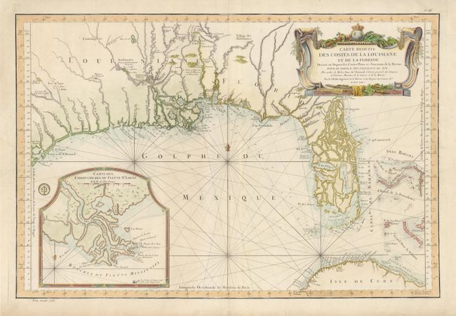
Auction 132, Lot 182
Subject: Colonial South - Florida & Bahamas
Bellin, Jacques Nicolas
Carte Reduite des Costes de la Louisiane et de la Floride…, 1764
Size: 33.2 x 22.2 inches (84.3 x 56.4 cm)
Estimate: $3,000 - $3,750
Unsold
Closed on 6/2/2010
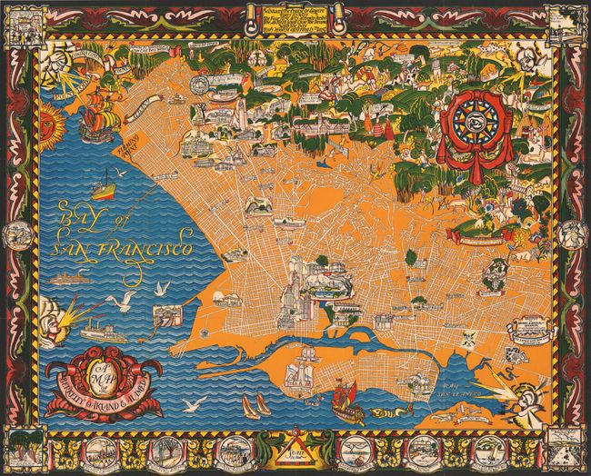
Auction 132, Lot 227
Subject: Berkley, Oakland, Alameda - California
A Map of Berkley Oakland and Alameda, 1930
Size: 42.8 x 34.6 inches (108.7 x 87.9 cm)
Estimate: $200 - $300
Sold for: $650
Closed on 6/2/2010
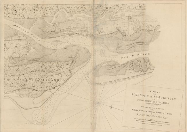
Auction 132, Lot 239
Subject: St. Augustine, Florida
Des Barres, Joseph Frederick Wallet
A Plan of the Harbour of St. Augustin in the Province of Georgia Composed & Published from Surveys…, 1780
Size: 39.3 x 27.5 inches (99.8 x 69.9 cm)
Estimate: $2,750 - $3,500
Sold for: $2,100
Closed on 6/2/2010
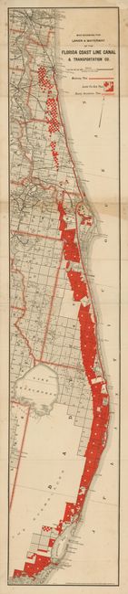
Auction 132, Lot 243
Subject: Florida
Matthews-Northrup Co
Map Showing the Lands & Waterway of the Florida Coast Line Canal & Transportation Co., 1889-93
Size: 7 x 36.6 inches (17.8 x 93 cm)
Estimate: $350 - $500
Sold for: $400
Closed on 6/2/2010
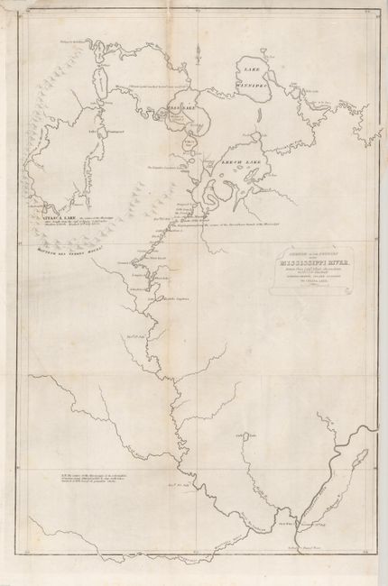
Auction 132, Lot 268
Subject: Minnesota
Schoolcraft, Henry Rowe
Sketch of the Sources of the Mississippi River, Drawn from Lieut. Allen's observations in 1832…, 1834
Size: 13.3 x 20.3 inches (33.8 x 51.6 cm)
Estimate: $400 - $500
Sold for: $250
Closed on 6/2/2010
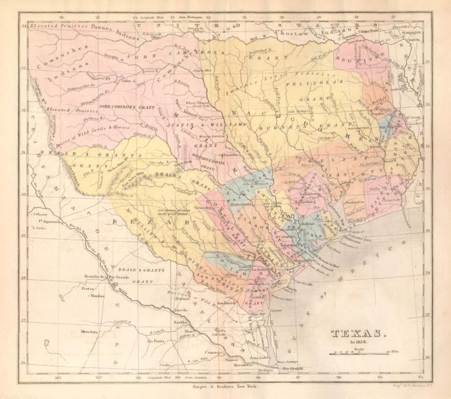
Auction 132, Lot 294
Subject: Republic of Texas
Kemble, W.
Texas in 1836, 1846
Size: 9.3 x 8.3 inches (23.6 x 21.1 cm)
Estimate: $400 - $600
Sold for: $950
Closed on 6/2/2010
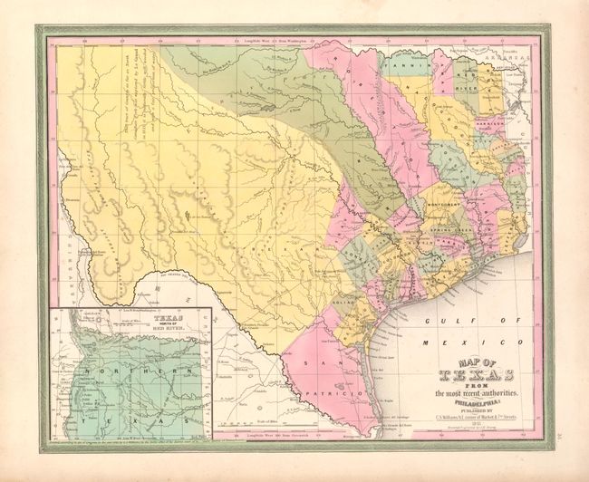
Auction 132, Lot 295
Subject: Texas
Williams, C. S.
Map of Texas from the most recent authorities, 1845
Size: 14.5 x 12 inches (36.8 x 30.5 cm)
Estimate: $900 - $1,200
Sold for: $1,300
Closed on 6/2/2010
12 lots